De Bleek Viewpoint: free parking, but you do need a dune pass
De Bleek Viewpoint is a lookout dune south-east of Egmond aan Zee, in the Noordhollands Duinreservaat of PWN. From the age of 18 you need a dune pass, from 2.00 euros for a day, but the car park at the foot is free. The sources disagree about the height: OpenStreetMap holds to 33 metres, Geologie van Nederland writes as much as 35 metres.
Beheerder
PWN
The lookout dune stands 1.2 kilometres as the crow flies from Egmond aan Zee, on the inner edge of the dunes, and it belongs to the Noordhollands Duinreservaat, the dune reserve of PWN, the water company of the province of Noord-Holland. That last fact determines the rest of your visit: parking here is free, but walking up the dune is only allowed with a dune pass.
How high is De Bleek Viewpoint?
Two sources, two figures, and we choose neither of them.
OpenStreetMap has the point as node 1571325414, tourism=viewpoint, with ele=33. So 33 metres. Geologie van Nederland, a publication in which the geologist Jeroen Schokker describes the dune, opens with a dune of as much as 35 metres high. That “as much as” is not a measurement, and the OSM figure is not a survey report that we could check.
That is why the height field on this page is empty. What you can hold on to: it is a substantial dune for this coast, but no candidate for the highest. The Klimduin in Schoorl is 51 metres and the Catrijper Nok 55.4 metres, and those two figures can be traced back to a measurement.
Do you need a dune pass here?
Yes. Rule 2 of the PWN access rules is clear: every visitor of 18 or older must carry a valid dune pass. Under 18 you do not need one.
What it costs, checked in PWN’s own ordering module on 6 September 2026:
- day pass: 2.00 euros
- week pass: 6.00 euros
- annual pass, digital: 14.50 euros, as a plastic card 18.00 euros
- three-year pass, digital: 42.50 euros, as a plastic card 47.50 euros
At the entrance to the reserve stands a machine where you buy a pass. Online is cheaper than at the machine or at a sales point according to PWN, and that difference is in the annual and three-year passes.
Note rule 1 as well: you may only visit the area between sunrise and sunset. Standing on the top before sunrise is therefore not allowed, however tempting the view.
Where can you park?
At the foot of the dune, and free. In OpenStreetMap that site is way 547481057 with fee=no, about 130 metres from the viewpoint. Geologie van Nederland calls the same site the De Bleek car park on the Van Oldenborghweg, right below the dune.
Navigate to Van Oldenborghweg 17, 1934 PH Egmond aan den Hoef. The entrance is tucked away at the end of two small roads through the market garden area. Two things to know before you drive there: the last stretch is called Weg naar de Bleek in OpenStreetMap and has a width restriction of 2.3 metres, so with a camper van or a wide van you will not get through. And the machine standing there is for your dune pass, not for the parking.
How many spaces the site has we have not been able to establish. Nobody publishes it and we have not counted them.
Without a car it is harder. Geologie van Nederland names the bus stop Speeltuin de Egmonden in Egmond aan Zee, a little over a kilometre’s walk away. Wandelnetwerk Noord-Holland names the stop Egmond aan de Hoef on the Rinnegommerlaan with lines 165 and 408. Whether those lines and stops still run that way in 2026 we have not checked against the timetable.
What do you see from the top?
Something different in every direction, and that is exactly why the dune has a name as a viewpoint.
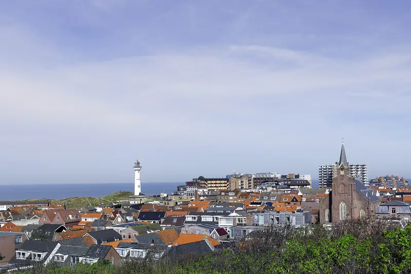
To the west you look out over a broad dune area of high, U-shaped parabolic dunes with vegetated dune flats between them, and the North Sea on the horizon. To the north-west the sea is precisely not visible, because Egmond aan Zee stands in the way. To the east you look over the beach ridges and the flats between them, where a great many flower bulbs are grown. To the north-east the church tower of Egmond aan den Hoef sticks out, and further east lie the silhouettes of Alkmaar and Heiloo.
That description comes from Geologie van Nederland and not from ourselves. We have not stood here, and the area at the foot was newly laid out in 2026, so the foreground probably no longer matches what you read in older texts.
Where does the name De Bleek come from?
From the bleaching of linen. Along the inner edge of the dunes clean fresh groundwater seeped up, and on the small fields there washed linen was laid out in the sun to whiten. The area called De Bleek lies at the foot of this lookout dune, and the dune has taken over the name of that field.
The province of Noord-Holland dates the bleaching fields to 1665, with landscape structures going back to the beginning of the 17th century. Geologie van Nederland keeps it wider, at the 17th and 18th centuries. On which side of the dune the field lies exactly we leave open: that same source writes south-west in one passage and south-east in another.
The dune itself came into being about a thousand years ago according to Geologie van Nederland and has been declared an aardkundig monument, a geological heritage site, because it shows clearly that the dunes here were formed not only by wind and sea but by people as well. Exactly when that designation was made and under which decision, we have not found.
What happened to the De Bleek area in 2026?
About 11 hectares of former farmland have been laid out anew as nature, and on 20 August 2026 the completion was celebrated. The province of Noord-Holland reports this itself.
Stichting De Bleek, the foundation that owns the land, took the initiative. PWN did the planning and the works and continues to manage the area together with the foundation, the province paid, the Hoogheemraadschap Hollands Noorderkwartier, the regional water authority, advised on the water and the municipality of Bergen took part as local partner. Damp hay meadow, wet dune slacks, nollen (small dune hillocks), flower-rich grassland, half-open dune woodland and pools were created. The historic bleaching ditches have been restored and carry water again. In the autumn of 2026 some finishing work still follows.
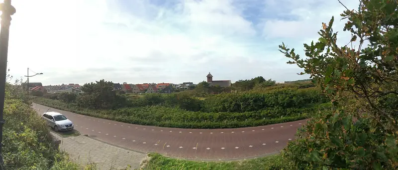
For you as a visitor two sentences matter. The site itself you cannot simply walk into, walking around it is possible, on the surfaced road. And along the Weg naar de Bleek a new viewpoint with an information board has been laid out that looks over the bleaching fields. That is therefore a different point from the lookout dune this page is about, and it stands a good deal lower.
Can the dog come?
Yes, on a short lead. Dogs are welcome in the Noordhollands Duinreservaat on the surfaced and unsurfaced paths, unless signs say otherwise, and the lead is compulsory.
There is a catch in those same rules: if you leave the roads and paths, the dog may not come along, not even on a lead. Leaving the paths is not allowed here anyway, except on the official play areas. During the breeding season certain parts are visibly closed off.
Whether a sign at this entrance or on the stairway to the top departs from the general rules, we have not seen on the spot.
Which walking routes start here?
Two waymarked dune routes of PWN, both from this entrance. Rondje Soeckebakker is waymarked in yellow, the Albertdalpad with blue triangles.
About the lengths the sources do not agree. Noordhollandseduinen.nl names 4.7 and 3.9 kilometres, Wandelnetwerk Noord-Holland comes to 4.69 and 3.55 kilometres for those same two routes. We have not walked them and not measured them.
You start with a climb: behind a kissing gate a steep stairway goes into the area. In OpenStreetMap there are three stretches of stairway at the top, but without a step count. So how many steps there are, we do not know.
Part of: Everything about Egmond aan Zee · Lighthouse, promenade and plenty of places to eat