The Zwarte Blink near Schoorl: 32.3 metres, and no car anywhere near
The Zwarte Blink is a viewpoint in the Schoorlse Duinen (the Schoorl dunes), managed by Staatsbosbeheer, with a bench and a picnic table on the top. In the national elevation model AHN4 we measure 32.3 metres above NAP; OpenStreetMap and the tourist sites hold to 31 metres. You can only get there on foot or by bike.
Beheerder
Staatsbosbeheer
Hoogte
32.3 m
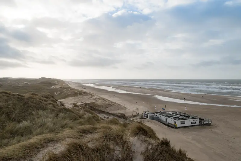
A bench, a picnic table and a few wooden stairways, in the middle of the sand. The Zwarte Blink is a dune top in the Schoorlse Duinen (the Schoorl dunes) with no road running to it: the Schoorlse Zeeweg that passes below it is a cycle path, not a car road. Every source we checked copies 31 metres from the last. The national elevation model says something else.
How high is the Zwarte Blink?
32.3 metres above NAP (Normaal Amsterdams Peil, the Dutch ordnance datum, roughly mean sea level), measured in the Actueel Hoogtebestand Nederland, the national elevation model, version 4. That is the half-metre ground-level grid captured with laser altimetry between 2020 and 2022, and anyone can request it through the open map service PDOK. The highest point comes out at 32.29 metres, at 52.69920 / 4.65473.
It is not measurement noise. Above 32 metres there is more than 24 square metres of ground, above 31 metres more than 267. That is a genuinely broad top and not a single outlier in the grid.
Every source we found holds to 31 metres: OpenStreetMap, ontdek-schoorl.nl, noordhollandseduinen.nl. In OpenStreetMap that height was only entered by a volunteer on 24 September 2024, first as 31.5 and corrected to 31 a day later. Where that figure originally comes from we have not been able to establish. Staatsbosbeheer, the Dutch state forestry service, publishes no height for this dune itself.
To test whether our measurement holds up, we ran it on a dune with a known figure. The Catrijper Nok is officially 55.4 metres; the elevation model gives 55.31 there. Nine centimetres of difference. The same method gives 32.29 here, and we trust that more than a round number with no provenance.
The highest dune in the area it just is not. Within a kilometre there is an unnamed top of 32.49 metres, roughly 974 metres north-north-east. Twenty centimetres higher, which amounts to nothing, but it is enough to deny the Zwarte Blink a record. What this dune is known for is the view all round, and that comes from its position in the open sand and not from its height. For comparison: the Klimduin lies 2.5 kilometres to the east, the Catrijper Nok 2.2 kilometres to the north-east, and the sea begins at 1.3 kilometres.
How many steps go to the top?
Staatsbosbeheer publishes no step count. OpenStreetMap does, and near the top it has three separate wooden stairways with handrails, all three registered to Staatsbosbeheer: one of 49 steps at 56 metres from the top, one of 18 steps at 16 metres, and one of 5 steps right by the bench. Seventy-two in total, spread over the climb, with stretches of path in between.
That mapping is young. The stairway of 18 steps, a wooden boardwalk and a free bicycle park at the foot were all three drawn in for the first time on 24 July 2026, and the stairway of 49 steps was updated the same day. That points to work on the approach shortly before, but Staatsbosbeheer has published no notice about it that we could find.
Note what it is not: the stairway of 416 steps that Staatsbosbeheer had replaced in corten steel in December 2022 with support from the Buitenfonds stands at the Buitencentrum, the visitor centre, and not here. Those two are often mixed up.
Can you get there by car?
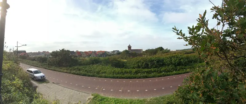
No. The Schoorlse Zeeweg alongside the dune is in OpenStreetMap as an asphalt cycle path with sign G13, open to pedestrians, closed to mopeds and cars. Within 700 metres of the top there is not a single road you are allowed to drive on.
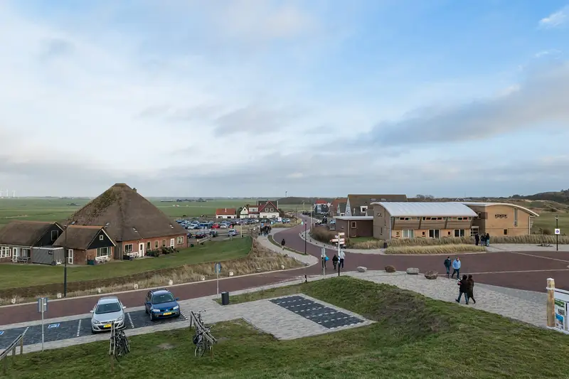
The nearest public car park is the one at Hargen aan Zee, roughly 1.7 kilometres away as the crow flies, and paid. After that comes P2 at the Buitencentrum Schoorlse Duinen at roughly 2.4 kilometres. What those sites cost and how many spaces they have, we have not measured for this page.
By bike it is simpler: at the foot there has been a free bicycle park on sand since July 2026, roughly 83 metres from the top. The top is not wheelchair accessible, because it is a stairway; the asphalt cycle paths around it are, according to Staatsbosbeheer, with assistance because of the gradients.
What stands on the top?
A wooden bench with a backrest, three metres from the highest point, and a picnic table at nine metres. Both appear as separate objects in OpenStreetMap and are also mentioned by ontdek-schoorl.nl and noordhollandseduinen.nl, so that is confirmed from two sides.
They both carry an inscription. The bench reads: “Als je vroeg begint kun je een hoop doen”, if you start early you can get a lot done, with the name A.P. Blaauboer underneath. The picnic table bears the word COMPSOOS, and below it: Computer Sociëteit BES, 2003 - 2018. Who those people are and why their name stands here, we have not been able to establish.
Where does the name come from?
From the word blink, which in the dune region means a white, unvegetated dune top. That is how it stands in “Nollen, krochten, blinken”, the study of dune place names between Wijk aan Zee and Camperduin that Frits David Zeiler wrote for PWN in 1995, covering exactly this stretch of coast. The Etymologisch Woordenboek van het Nederlands, the etymological dictionary of Dutch, arrives at the same thing: a blinkerd is a high bare dune top, derived from blinken, to shine, named after the light colour that stands out against the vegetation. The oldest recorded use is 1610.
Several tourist sites write that the name comes from the dark glinting of the sand, most visible at dusk. That clashes with the toponymy, because a blink is precisely light. Why this blink is called black is in no source we could check. Zeiler does not mention the Zwarte Blink by name.
Are you allowed to mountain bike here?
Probably not any more. The mountain bike route used to run past here, but in OpenStreetMap the paths concerned are marked as a former route, removed from this area and moved further east, checked on 27 September 2024. Some of those paths are now on access=no, and the paths at the top itself on bicycle=no. The route manager writes on mountainbikeroute-schoorl.nl about three routes in one network that opened in 2024.
Trailforks and AllTrails still list a trail by the name of Zwarte Blink of roughly 1,697 metres. That listing looks out of date, but we have found no official notice from Staatsbosbeheer confirming the move. Look at the signs on the spot.
Can the dog come?
In the Schoorlse Duinen the dog is welcome all year round. From 1 March to 1 September he has to be on the lead because of nesting birds, outside that period he may run free if he comes when called. In the grazing areas he may not come, and since August 2026 sheep have been grazing in the Schoorl dunes.
There is a caveat to this. Three paths right by the top are on dog=no in OpenStreetMap, updated on 13 May 2025 and 24 July 2026. That fits what Staatsbosbeheer says about grazing areas and certain routes, but whether the top itself falls within such an area, we could not establish on 6 September 2026. There is no map that publishes this per path. The signs at the entrance are what counts here, not this page.
Which walking route goes over it?
The Duinheidewandeling, the purple route, 11 kilometres, starting at the Buitencentrum Schoorlse Duinen with parking on the Oorsprongweg. According to ontdek-schoorl.nl that is the only local route that goes over the top of the Zwarte Blink.
The rest of the area you walk on the official paths. Roaming off the path is allowed in only five places in the Schoorlse Duinen: Jan Bas z’n tuintje, de Speelkuil, Wulpendal, de Hargerplas and het Groeter Zandgat. The Zwarte Blink is not one of them, so stay on the stairway and the path. Access to the area is free and open all year round.
Part of: Everything about Schoorl · Highest dunes and planted pine forest