Walking in the Schoorlse Duinen: the Stuifduinentocht, 17 kilometres
The Stuifduinentocht is 17 kilometres long, starts at Buitencentrum Schoorlse Duinen at Oorsprongweg 1 in Schoorl and is waymarked with white arrows. The route runs largely over unsurfaced ground and, according to Staatsbosbeheer, is not suitable for walking with a dog, because you pass through a grazing area.
Seventeen kilometres, waymarking white, start at the Buitencentrum at Oorsprongweg 1. Those are the three things Staatsbosbeheer, the Dutch state forestry service, records itself about this route, on the route page and in the route leaflet. A walking time is not given, a difficulty grade is not either. On the map in the leaflet it is a closed loop: you finish where you began. The full Dutch name is Boswachterspad Stuifduinentocht, the ranger trail through the drifting dunes.
Where does the Stuifduinentocht start?
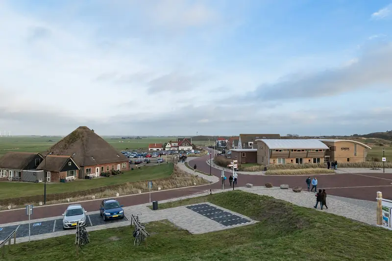
At Buitencentrum Schoorlse Duinen, the visitor centre for the Schoorl dunes, at Oorsprongweg 1, 1871 HA Schoorl. Navigate to Heereweg 62, because the turning to the Oorsprongweg lies directly opposite that address. Turn left there and immediately right again to stay on the Oorsprongweg. The visitor centre and the car parks are at the first turning on the left.
According to the Basisregistratie Adressen en Gebouwen, the Dutch national address register, Oorsprongweg 1 lies at 52.70618 north and 4.68915 east. OpenStreetMap puts the visitor centre in the same spot.
Without a car: from Alkmaar station bus 151 runs to Schoorl, get off at the Idenslaan stop. How many metres it is from that stop to the starting point, Staatsbosbeheer does not say and we have not measured.
How long is the route really?
17 kilometres. That figure appears three times at Staatsbosbeheer: on the route page, in the heading of the route leaflet and in the legend of the map. A shortened variant is not indicated, so you either walk the whole thing or you do not walk it.
If you want the same area but shorter, more waymarked routes start at the same visitor centre. The Familieroute, the family route, is 4.4 kilometres and yellow, the Noordzeewandeling or North Sea walk 10 kilometres with dark blue arrows, the Duinheidewandeling or dune heath walk 11 kilometres in purple. Longer is possible too: the Duintoppentocht, along the dune tops, is 23 kilometres.
How much climbing you do along the way, Staatsbosbeheer does not give. We have not measured it, so it is not here. In an area with the highest dunes in the Netherlands that is a real gap, but an invented figure is worse than a missing one.
How hard is the walking?
Staatsbosbeheer gives no difficulty grade and no walking time. What it does say: the walk runs largely over unsurfaced ground, and the forest is semi-surfaced. Forest ranger Denise van Dillen calls it a challenging walk and says the route is one for the adventurer.
We rate it hard. That is our judgement and not a classification by the manager. Seventeen kilometres of which a good part goes over drifting dunes and blowing sand walks differently from seventeen kilometres of forest track. On the Noordzeewandeling, which is ten kilometres and partly crosses the same area, Staatsbosbeheer warns explicitly about stretches of loose sand towards the sea.
So do not count on your usual walking pace, and take water with you. There is exactly one place to eat or drink along the way, and it is closed for part of the year.
Can the dog come along?
No. With this route Staatsbosbeheer writes that it is not suitable for walking with a dog, because you pass through a grazing area where dogs are not allowed. That is not advice but an area rule. You recognise grazing areas by their fences, cattle grids and signs.
The same sentence appears word for word with the Noordzeewandeling of 10 kilometres and with the Duinheidewandeling of 11 kilometres. With the Familieroute of 4.4 kilometres, Staatsbosbeheer says nothing about dogs, and saying nothing is not permission. Staatsbosbeheer itself refers dog owners to the desk at the visitor centre for alternatives. Which route is recommended there, we have not been able to establish.
In the Schoorlse Duinen as a whole the dog may come along all year round: from 1 March to 1 September on a lead because of the breeding season, outside that period off the lead as long as he comes when called. That general rule does not help you on this route, because he is not allowed into the grazing area at all.
Where do you park and what does it cost?
In the car parks by the Buitencentrum, at the first turning on the left off the Oorsprongweg. On the zone map of ParkeerService, the parking service of the municipality of Bergen, the whole Oorsprongweg lies in zone B, not in the more expensive zone A of the village centre on the Heereweg. That saves money.
Zone B costs 2.45 euros per hour in 2026, with a maximum of 14.70 euros a day. After six hours you therefore pay nothing more. In zone A the rate rises after an hour and a half to 4.90 euros per hour and there is no daily maximum at all, so do not leave the car in the village for a walk of this length.
From 1 March to 1 November you pay daily from 10.00 to 19.00. From 1 November to 1 March on Saturday and Sunday only, on winter weekdays you park free. That applies on public holidays too. Before 10.00 and after 19.00 you pay nothing all year round.
How many spaces there are at the visitor centre, we have not been able to establish. Do bear in mind that all the waymarked routes we have checked leave from this one point, so you share the site with the short-distance walkers.
What do you come across along the way?
Staatsbosbeheer marks six numbered points on the route leaflet, and together they tell the story of this area.
The burnt forest. Between 2009 and 2011 dune fires raged here. Stichting Duinbehoud, the Dutch dune conservation foundation, puts the affected area at 270 hectares; NH Nieuws, the regional news outlet, counts ninety small and four large fires over those years, with the worst on 28 August 2009. What you see now is therefore not a ruin but a recovery.
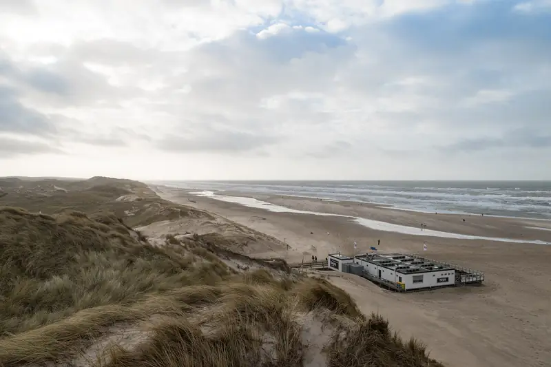
The Baaknol sand drift, where you read animal tracks in the loose sand. The beach, where the young dunes grow along with the sea water and are allowed to drift freely. The Bokkenweide, a former tree nursery that was used to plant up these forests.
And De Kerf, where according to the leaflet nature was let loose in 1997 and sand, water and wind were given free rein. That year comes from the Staatsbosbeheer route leaflet and we have had it confirmed nowhere else.
The sixth point is the dennenorchis, creeping lady’s-tresses. The leaflet puts its flowering in June, the route page of the same organisation keeps to May and the summer months. Those two do not match, and which of the two is right we do not know.
Can you get a drink along the way?
At the start, Brasserie IJgenweis is in the Buitencentrum. Along the way Staatsbosbeheer names one address: Strandpaviljoen Paal 29, a beach pavilion, and according to them it is there between March and September.
So if you walk this route in October, November, December, January or February, there is nothing between start and finish. Seventeen kilometres without coffee and without a toilet, unless you come across something along the way that Staatsbosbeheer does not name. We have not been able to find the opening hours of the Buitencentrum itself at Staatsbosbeheer, so do not assume you can still get inside afterwards either.
Checked on 6 September 2026 with Staatsbosbeheer, the Boswachterspad Stuifduinentocht route leaflet, ParkeerService of the municipality of Bergen and the Basisregistratie Adressen en Gebouwen. Walking time, height gain, number of parking spaces, the distance from the Idenslaan stop to the starting point and the opening hours of the visitor centre are missing on purpose: we could not find them in a checkable source.
Part of: Everything about Schoorl · Highest dunes and planted pine forest